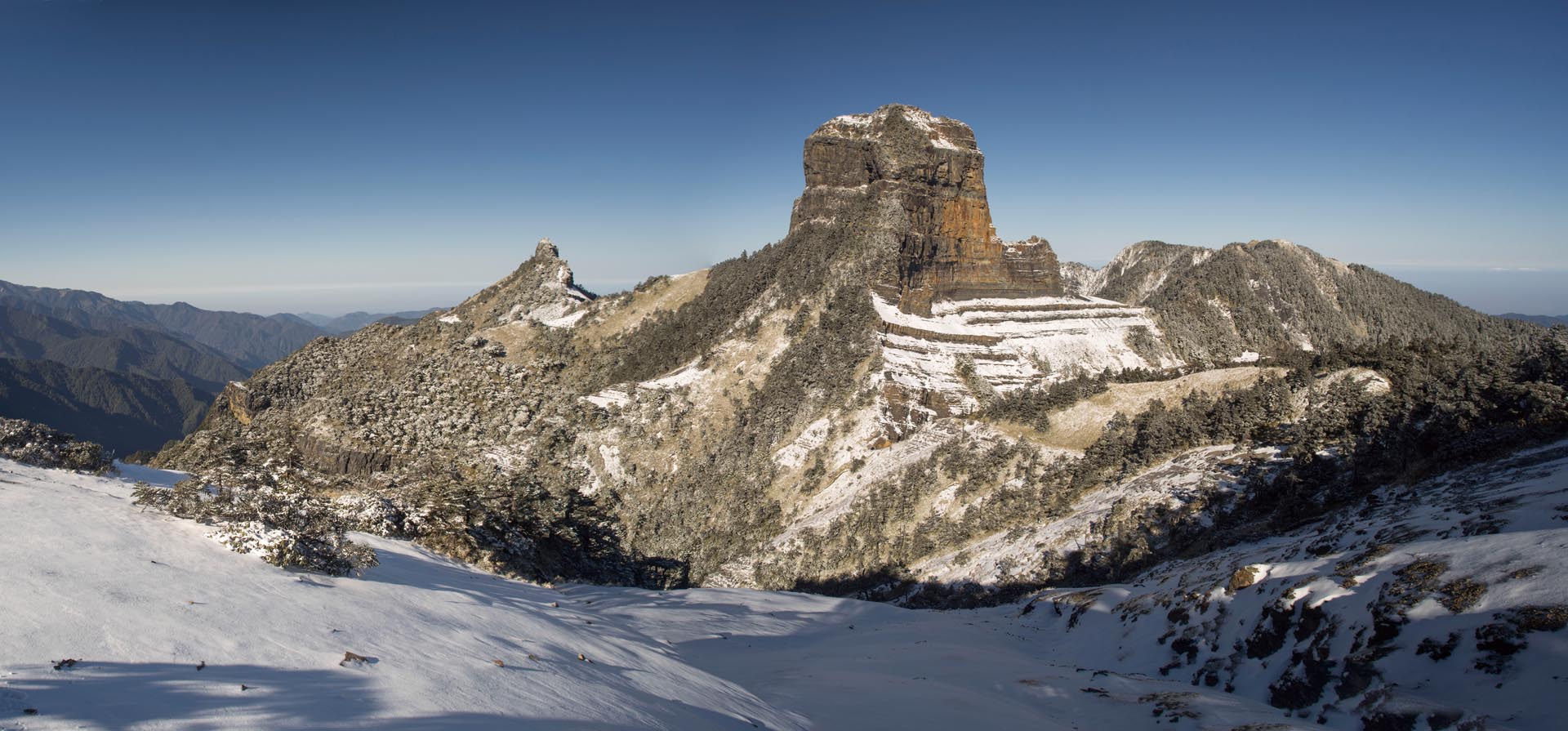
Shei-Pa Mountain

As most national park systems of the world, the National Park Department of Taiwan operates under the overriding dual purposes of protecting the natural and cultural resources of the nation and of providing quality recreational opportunities for the citizens.

More specifically, the goals of the National Park System in Taiwan include: the protection of ecologically significant areas, the conservation of gene pools, the provision of nature-related recreational opportunities, the promotion of scientific research and environmental education, and the stimulation of regional economic growth through compatible tourism development.

Today, the Shei-Pa National Park Headquarters is actively engaged in studying the natural resources and history of the area in order to improve conservation and expand education programs for the public about environmental issues. The park authorities hope both to improve the quality of leisure activities in the park and to expand academic studies.

The purpose of this short publication is to present to English speaking visitors an introductory look at Shei-Pa National Park. Hopefully, the words and photographs will encourage readers to visit Shei-Pa National Park and, when they do, to respect national treasures.

Travelling is not just travelling; what is more important is to take an easy attitude to absorb information, enjoy life, and grow up through travelling. Your visit is very welcome.

Shei-Pa National Park Headquarters

When we are trying to gain some understanding of any national park, it is useful to consider in what country and what area the park lies. Shei-Pa National Park is in Taiwan, so a quick review of Taiwan may be helpful here.

Taiwan, or Formosa as it used to be called, is an island about 160 kilometers off the southeast coast of Mainland China, between Japan and Philippines on a line running north-southwest. It is approximately 36,000 square kilometers in size, about the same size as Holland, and a little larger than Massachusetts and Connecticut States combined. Three quarters of the land area is mountainous, much of it too steep to be cultivated easily. There are more than 200 peaks over 3,000 meters in altitude. The highest of them, Jade Mountain reaches 3,952 meters.

Location of Taiwan The location of Taiwan
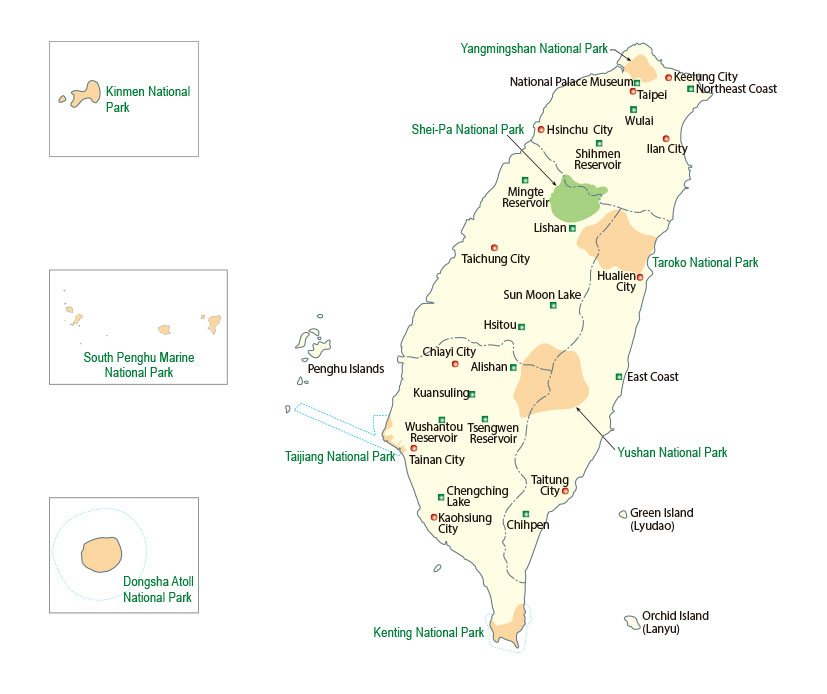
The Distribution of National parks in Taiwan The Distribution of National Parks in Taiwan
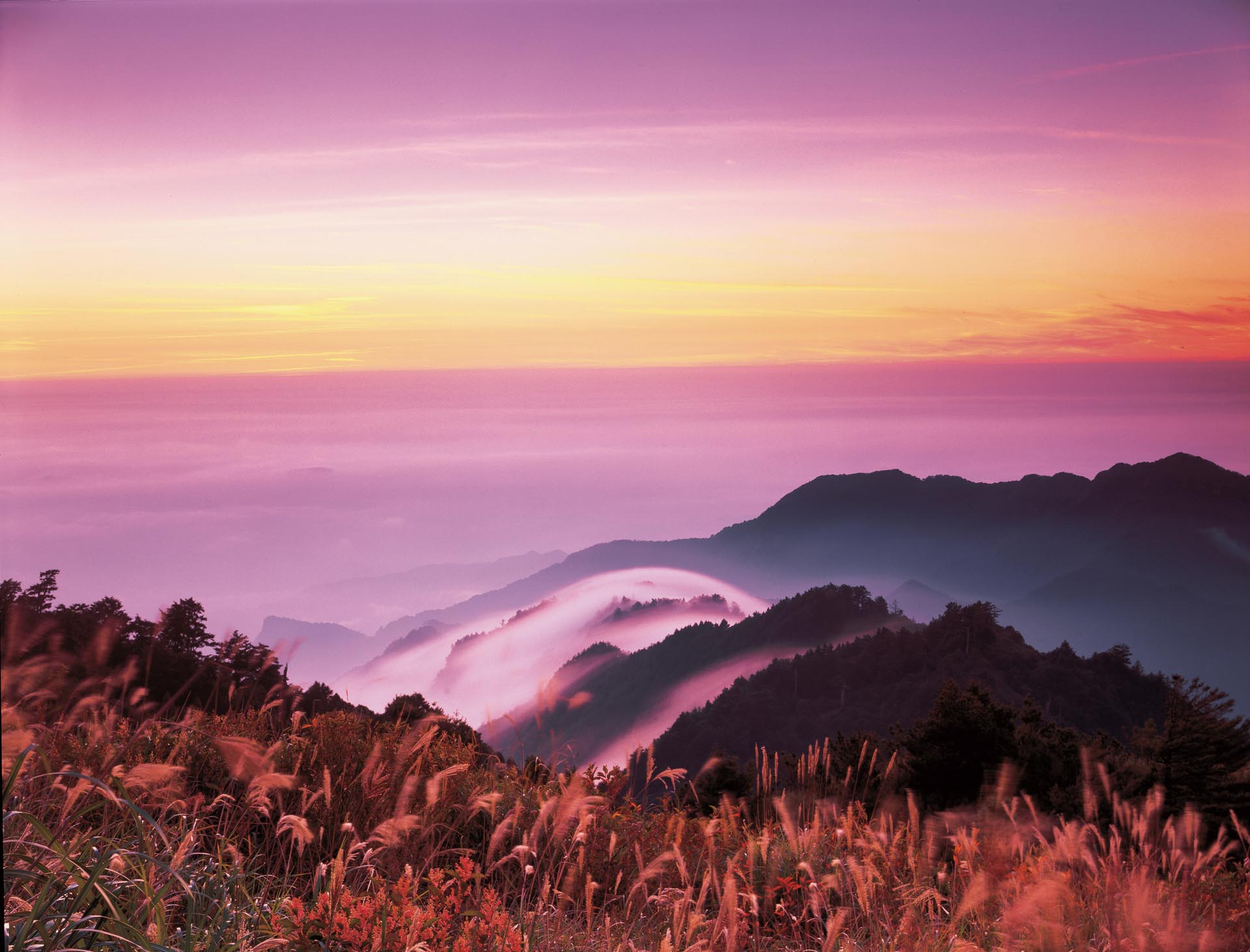
Seas of clouds and beautiful sunsets attract  visitors to the park. Seas of clouds and beautiful sunsets attract visitors to the park.

The climate is subtropical, and rainfall is heavy: average annual rainfall in the north is 100 inches (2,540 mm).

The population now numbers 23 million, mainly ethnic Chinese, but including also more than 300,000 aborigines of south Pacific ancestry, languages and culture. The people live mostly on the level plains, where the population density is very high. Taiwan has changed from an agricultural to a predominantly industrial society. Taiwan, with its warm climate, abundant rainfall, steep mountains and valleys, is rich in natural resources co-existing in a delicate equilibrium. This equilibrium is particularly threatened in two ways: firstly, owing to the steepness of the slopes and the force of the rainfalls, the forest cover is essential to prevent erosion, with loss both of soil and of water.

Secondly, the rapid development of human life causes many kinds of disturbance to the ecology, with the danger that today's advantages might be at the expense of man's future. This situation gives a particular urgency to the work of the national parks: to prevent certain chosen parts of the country from being overwhelmed by industrial growth; to provide areas where people can get recreation and exercise in contact with nature; and, especially important in a rapidly developing country, teach visitors to the park how to enjoy, understand and protect the wild life around them.
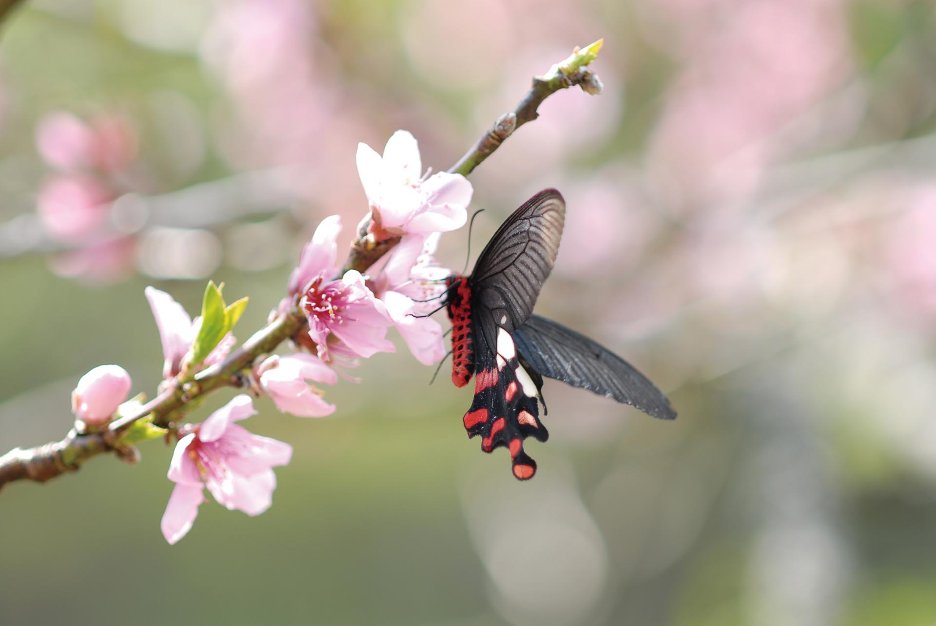
Common Rose, a swallowtail butterfly, is easy to be found in the mountainous areas. Common Rose, a swallowtail butterfly, is easy to be found in the mountainous areas.
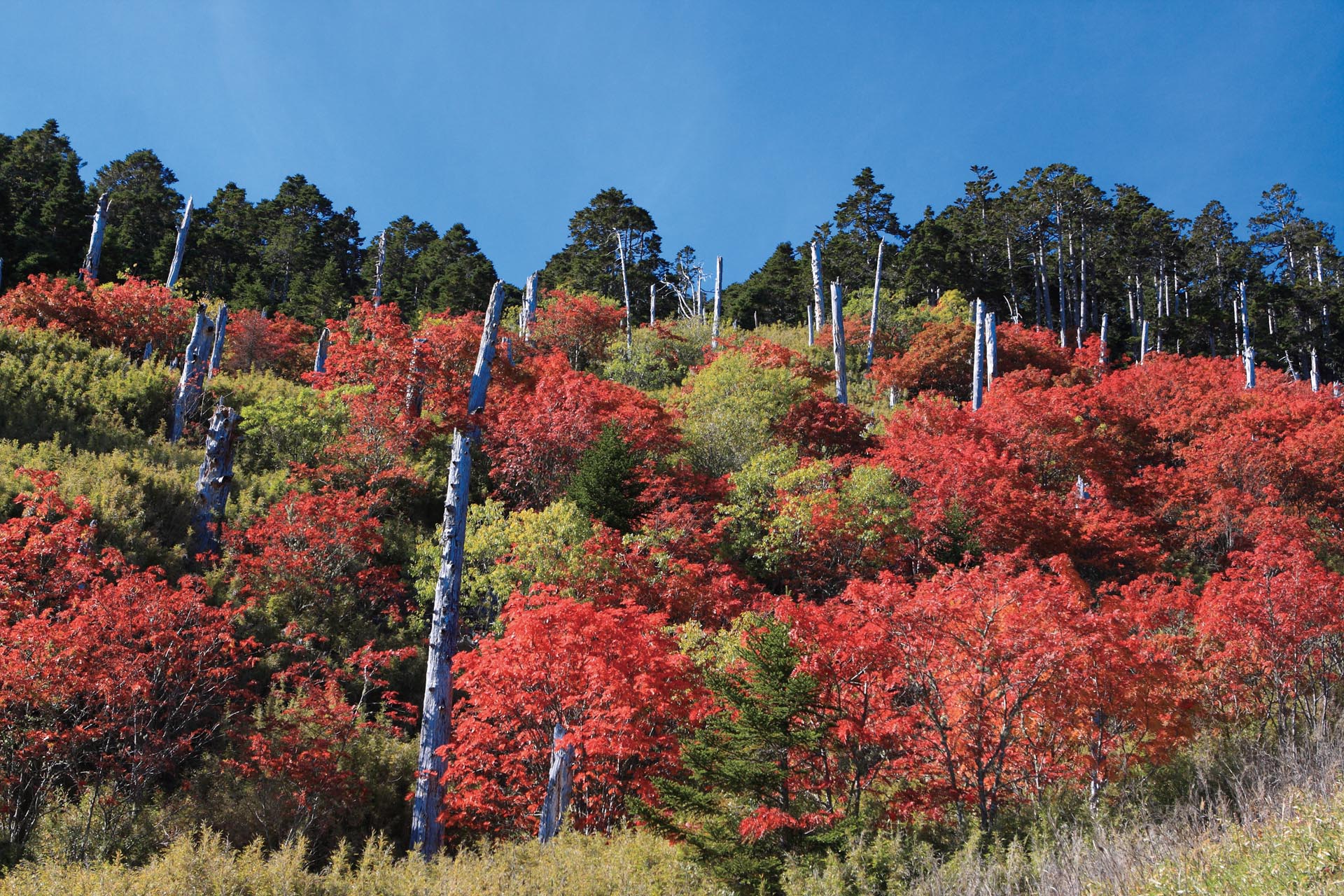
In autumn, the leaves of Taiwan Mountain Ash turning from green to red attract people to the high mountains. In autumn, the leaves of Taiwan Mountain Ash turning from green to red attract people to the high mountains.

NATIONAL PARKS OF TAIWAN

Most national parks, as well as working for these general aims, also have their own specific character and related aims, and this is true of the nine parks now established in Taiwan. (See table)

Table giving brief description of the nine national parks of Taiwan

 
Region Name of National Park Important resources for conservation Area in hectares Date:
Plan announced publicly.
H.Q. set up
South Kenting National Park Raised coral reefs
Coastal forest
Tropical monsoon forest
Prehistorical remains
Maritime ecology
18,083.5 (inland)
15,206.09(coastal)
33,289.59(total)
1 Sept. 1982
1 Jan. 1984
Central Yushan National Park High mountain topography
High mountain ecology
Spectacular peaks
Variety of forest types
Abundant animal life
Remains of old road
103,121.4 6 April 1985
10 April 1985
North Yangmingshan National Park Volcanic geology
Hot springs
Waterfalls
Grassland
Broad-leaved forest
Butterflies
11,338 Sept. 1985
16 Sept. 1985
East Taroko National Park Marble gorge
Scarp cliff along fault line
Fold
Variety of forest types
Rich animal life
Remains of old road
92,000 Nov. 1985
28 Nov. 198
Central Shei-Pa National Park High mountain ecology, geology, topography
Rivers and creek valleys
Rare animals and plants
Plentiful variety of forest types
76,850 1 July 1992
1 July 1992
Not on Taiwan Island Kinmen National Park Battlefield memories
Traditional villages
Pools and marshes
Coastal topography
Coastal forms of animal and plant life
3,528.74 18 Aug. 1995
18 Aug. 1995
Not on Taiwan Island Dongsha Atoll National Park High biodiversity of coral reef ecosystem
Marine culture and history
Complete and distinctive atoll terrain
168.97(inland)
353,498.98(coastal)
353,667.95 (total)
17 Jan. 2007
4 Oct. 2007
(overseen by Marine National Park Headquarters )
South Taijiang National Park Wetlands ecology
Tidal land and sandbanks
Historic navigation channels
Salt industry and other special sights
4,905(inland)
34,405(coastal)
39,310 (total)
28 Sept. 2009
28 Dec. 2009
Not on Taiwan Island South Penghu Marine National Park Basalt volcanic landscape
Historical and cultural sites
High biodiversity of coral reef ecosystem
370.29(inland)
34,473.33(coastal)
35,843.62 (total)
8 June 2014
4 Oct. 2007
(overseen by Marine National Park Headquarters )
Total area     311,498.15(inland)
438,573.80(coastal)
750,071.95 (total)
The total inland area is 8.63% of whole Taiwan island

Dabajian Mountain is Shei-Pa National Park's landmark and the foremost of 'Taiwan Triple Sharp Mountains'. Dabajian Mountain is Shei-Pa National Park's landmark and the foremost of 'Taiwan Triple Sharp Mountains'. It is also worshiped as a holy mountain for Atayal people.

Shei-Pa National Park covers an area of 76,850 hectares on the central Taiwan range, slightly to the north of central Taiwan. This is a region of magnificent mountains: within the park are 51 peaks over 3,000 meters high. It is a mostly wild and undeveloped area with a range of wildlife that includes many rare and endemic species. The park was founded to protect and study this splendid wilderness, maintaining the natural environment and all forms of life it includes. Conservation is therefore the first priority for Shei-Pa National Park, and a large proportion of its land is protected as conservation area. (See ground plan)

GROUND PLAN OF SHEI-PA NATIONAL PARK

Under the National Parks Law, the parks are required actively to promote resource conservation, research, recreation and sustainability of use. To further the attainment of these ends, Shei-Pa National Park is divided into five types of management zone, with different levels of restriction and control over land use:

Conservation Area

Natural biotic communities and their habitats, which are strictly protected for ecological research. The unauthorized collection of specimens, the use of pesticides, and construction of any kind are forbidden.

Special Scenic Area

Areas of special natural features which could not be recreated, and in which development must be strictly controlled.

Recreation Area

Areas suitable for various outdoor leisure activities. The construction of recreational facilities and limited exploitation are permitted. The areas of this type are the Wuling, Guanwu, and Syuejian Recreation Areas.

General Protection Area

Areas of land and water not within other zone types, including existing small villages. Continuation of existing land use modes is permitted.

Historical Preservation Area

Areas placed under control to preserve important historical buildings, memorable sites, settlements, historical monuments, ruins, cultural landscapes, relics, as well as recognized ancestral graves, sites of worship, sites of origins, old tribal land, ruins, and historical monuments of the indigenous peoples and preserved in accordance with the indigenous cultures and customs.

Cirque is a widely famous geographical feature on Syue Mountain. Cirque is a widely famous geographical feature on Syue Mountain.

This is a region of magnificent mountains: within the park are 51 peaks over 3,000 meters high. The range of altitudes in the park is from 760 meters above sea level in the Da-an River Valley to 3,886 meters at the top of Syue Mountain.

The name, Shei-Pa, refers to two notable mountains in the park: Syue Mountain and Dabajian Mountain. Syue Mountain (Xue Mountain or Snow Mountain) is the highest point of the Syue Mountain Range, which stretches northeast-southwest across Taiwan from Sandiaojiao to the Jhuoshuei River. At 3,886 meters, Syue Mountain is the second highest mountain in Taiwan, only a little lower than Jade Mountain, 3,952 meters, the highest mountain in Taiwan, or in all Eastern Asia. Syue Mountain is one of the "Taiwan Quintuple Mountains." Dabajian Mountain, 3,492 meters, is considered one of Taiwan's natural wonders because of its astonishing, awe-inspiring shape. An old legend of the local aborigines, the Atayal, tells how the whole human race originated from a couple who came out of a rock at the base of the mountain. The Atayal venerated Dabajian Mountain and would not ascend it without special reason; it was not until 1927 that mountain climbers from other places began to go up to it.

The Daba area is mainly thick-bedded sandstone. 'Horst' is a famous geographical feature. (Dongbajian Mountain). The Daba area is mainly thick-bedded sandstone. 'Horst' is a famous geographical feature. (Dongbajian Mountain).
The ridge stretches between Syue Mountain and Jhihjiayang Mountain. The ridge stretches between Syue Mountain and Jhihjiayang Mountain.

The mountains around Syue Mountain are connected by high ridges, of 3,300 to 3,500 meters in altitude. Shengling Trail, along the north-south ridge connecting the two mountains, is held in high honor both by aborigines and by mountain climbers. It is only some 10 kilometers on the map, but there are 7 other mountains over 3,000 meters on the way, which is difficult and dangerous going. Mountain climbers, starting from the border of the park, plan six days to complete the journey along the trail. In 1928, a Japanese explorer, Numatetu Tarou, writing about the Daba region, said he doubted if anyone could truly express the awesome mystery and beauty experienced along the Shengling Trail. Since many who go there share his feelings, the ridge is very often called the Holy Ridge.

The rock formations exposed in Shei-Pa National Park are mainly slightly metamor-phosed rocks from the Eocene to Miocene epochs of the Tertiary period. The degree of metamorphism decreases along an axis from southeast to northwest. Rock types include sandstones, shales and slates. Folded strata and high-angle reverse faults are commonly seen structures. Owing to the effects of the collision in eastern Taiwan of the Philippine Plate, moving northwest, with the Eurasian Plate, most fold axis planes and fault planes lie in a northeast to southwest orientation, with a curvature towards the northwest.

A geographical feature in the Syue Mountain region which has aroused much interest and discussion is the broken down rock faces around Syue Mountain. Before the evidence of glacial activity in the area became clear, geologists thought that the force of wind on the rock made it crumble into pieces which then slid down the slopes, leading to the formation of "landslide valleys." However, the later discovery of glacial phenomena such as glacial thresholds, U shaped valleys, glacial cols and glacial striation proved that glaciers did once occur around Syue Mountain.

Dasyue Mountain. Dasyue Mountain.
The U-shaped valley and glacial col of North Peak of Syue Mountain. The U-shaped valley and glacial col of North Peak of Syue Mountain.

"Cirque" is a general term in topography; it means a kind of circular hollowed-out place with an opening facing downhill and a very steep slope at the upper end. Glacial cirques are a feature of glacial topography, one type of cirque; the name indicates a circular hollow situated where the head of a mountain glacier was, hollowed out by the action of ice, snow and the glacier, and shaped like a great amphitheatre or basin, with very steep cliffs on the upper side.

Glacial Cirque No.1, the largest in Taiwan, has the rock slope on the upper side. Glacial Cirque No.1, the largest in Taiwan, has the rock slope on the upper side.
'Box fold' is a widely famous geographical feature on Pintian Mountain. 'Box fold' is a widely famous geographical feature on Pintian Mountain.

In the Syue Mountain area, these oval-shaped hollows are thirty seven in number; among them the glacial cirque below the summit of Main Peak of Syue Mountain, called "Glacial Cirque Number one" is the largest in Taiwan and has the finest form. The glacial cirque on the lower slopes of North Peak of Syue Mountain, called "Glacial Cirque Number two," has the most representative glacial cirque shape. Also in the Syue Mountain area, Cuei Pond and lower Cuei Pond were formed by glacial action and so can be called "glacial cirque ponds."

Breathtaking seas of clouds and sunset in the high mountain area. Breathtaking seas of clouds and sunset in the high mountain area.

The Tropic of Cancer crosses Taiwan almost 100 km south of Shei-Pa National Park, which therefore lies entirely in the subtropics. Temperatures, however, vary a great deal according to the altitude. The range of altitudes in the park is from 760 meters above sea level in the Da-an River Valley to 3,886 meters at the top of Syue Mountain; average temperatures to be expected during the year are as follows:

Altitude 1,000 meters in January 9℃
July 22℃
2,000 meters January 5℃
July 16℃

Precipitation is heavy: the park has an average annual rainfall of between 1,500 and 3,000 mm, the rainy season being from May when spring monsoons bring the heavy "plumrains," to October, by which the typhoons are usually over. There is also heavy precipitation in winter, with the higher peaks receiving it in the form of snow.

The northeast-southwest Syue Mountain Range divides the park into two different climatic regions: the land to the north of the range has Taiwan northwest mountain climate, with monsoon winds and typhoons causing heavy rainfall. The region to the south of the range has the climate of western slopes of the Central Mountains, with marked variations in rainfall.

Magnificent sea of clouds floating around the peaks of high mountains. Magnificent sea of clouds floating around the peaks of high mountains.
Cijiawan Creek. Cijiawan Creek.

Because of Taiwan's small area, dense population and steep terrain, it has few large lakes to act as natural reservoirs. Thus, water for public consumption, irrigation, and industry depends on artificial reservoirs. This makes water and soil conservation in the high mountain watershed areas particularly important. Shei-Pa cares for a large mountain area right in the middle of the northern half of Taiwan, and water from the park goes to supply northern, northeastern and central Taiwan. Watersheds divide the streams and rivers in the park into four systems:

* The northeast corner is drained by the Takejin Creek, flowing down from the Dabajian Mountain region to join the Danshuei River, which supplies water for Taipei City.

* The streams on the southeast slopes of the Syue Mountain Range join the great the Dajia River, which is more than 120 km long, feeds the Deji Reservoir and supplies water for Taichung City.

* The western half of the park is the watershed area of the Da-an River, which provides water for Miaoli County and Taichung City. The larger upper branches of the Da-an River include the Syueshan Creek coming down from the Syue Mountain Range, and, to the north, the Madara Creek. Madara is the aboriginal name and means "brown unclear water," a reference to the red-brown color of the river bed.

* In the northwest corner of the park, the slopes north of Le and Kuai Mountains drain into the Toucian River, which supplies water to Hsinchu City.

Taoshan Waterfal. Taoshan Waterfal.
Yousheng Creek. Yousheng Creek.

The water's gurgle is the voice of my father's father.
The rivers are our brothers;
they quench our thirst.
The rivers, between the tender arms of their banks, carry our canoes where they will.
~~ Chief Seattle

Cuei Pond, its pristine waters babble in perpetuity, surrounded by precious Yushan Juniper. Cuei Pond, its pristine waters babble in perpetuity, surrounded by precious Yushan Juniper.

The conservation work of the park includes the task of maintaining the quality of the water leaving its boundaries. Agricultural activity in the park can involve over-exploitation of mountain slope land and excessive land clearance, leading to soil erosion and overuse of agrichemicals, causing pollution of the streams. The park authorities endeavor to keep a balance between agricultural development and the maintenance of water quality.

There are not many high mountain lakes in Taiwan, but there are four or five in the park, including Cuei Pond near Syue Mountain, which, at the altitude of 3,530 meters, is the highest lake in Taiwan.